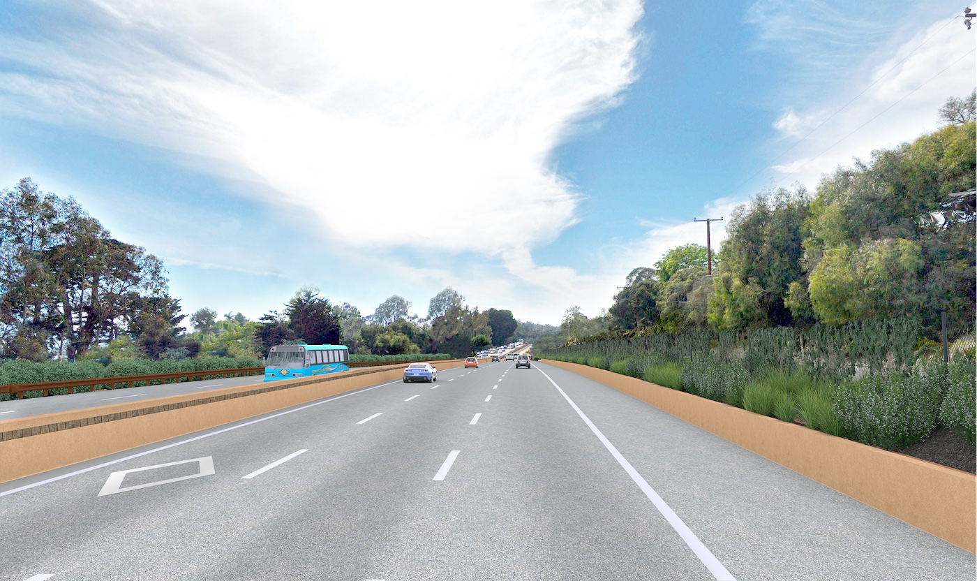
MPC Considers Highway 101 Project

The Montecito Planning Commission had its first opportunity to look at the freeway widening project through Montecito last week, with a conceptual hearing held last Wednesday. The project had previously been seen by Montecito Board of Architectural Review in September, February, and March.
Project planner Chris Schmuckal gave Commissioners a background on the regional transportation project, which is being led by Caltrans and Santa Barbara County Association of Governments (SBCAG). The Montecito segment of the project (called 4D) includes widening 1.4 miles of both directions of the freeway, from just before the Romero Creek bridge to Olive Mill Road; earlier segments include seven miles from Bailard Avenue to the Carpinteria city limit, Carpinteria to Padaro Lane, and Padaro Lane to Sheffield interchange, all of which is currently in progress.
The project will add a third, part time High Occupancy Vehicle (HOV) lane that will be in effect on weekdays from 6 am to 9 am, and 3 pm to 6 pm. During those peak times, cars utilizing the HOV lane must have two or more persons per vehicle. In addition, the project includes replacing the existing roadway pavement with 40-year concrete pavement; removal of 158 oak trees (to be replaced at a 3:1 or 2:1 ratio) and 20 other native trees (to be replaced at a 1:1 ratio); installation of median barriers, guardrails, fencing, retaining walls, and new landscaping; and replacement of the bridges over Romero Creek, San Ysidro Creek, and Oak Creek. The widening project is being designed with the most recent standards and safety upgrades, according to the planners.
SBCAG’s Fred Luna said the planning for the freeway widening began many years ago, with increased traffic causing 7.5 hours of delay in 2022, expected to increase to 11 hours per day in 2040. This is in addition to increased air pollution, increased traffic diverting off freeway onto local roads, and a decreased quality of life for communities between major commuter areas including Santa Barbara, Goleta, and Ventura. The project is being funded through federal, state, and local funds, including a significant portion through Measure A funds.
Project rep Kirsten Ayars said that the aesthetics of the much-discussed project were designed with a semi-rural feel, using drought tolerant landscaping and visual improvements, and that the project has undergone an extensive community process. Intents of the project include freeing up local lanes for local traffic, updating 1950s-era connections between Montecito and 101, and staying within existing right-of-ways. Two parallel projects in the segment – a roundabout at Olive Mill Road and Coast Village Road, and a roundabout at San Ysidro and North Jameson – aim to enhance local roads, helping pedestrian, bike, and vehicle access. “This enables local roads to function in the way they were intended to function,” Schmuckal said.
Most areas of the freeway project include widening into the median instead of the outside lanes, which makes building in the existing right-of-way possible, rather than condemning nearby properties to accommodate the increased footprint of the freeway. Much of the current existing median plantings are to be removed to accommodate the new lane, with shrubbery, vines, and trees focused on the perimeter of the freeway for screening purposes. One neighbor said he would prefer that his property be condemned for eminent domain, giving more space for the freeway and allowing an open-space buffer to the rest of the community.
Earlier this year, in a controversial move, planners removed the proposed sound walls on the project, which was a large point of discussion by the Commission. The reason for the removal was an increase in water rise that could occur during a flooding event; the flood risk was analyzed using Recovery Mapping that was adopted by the County in response to the 1/9 Debris Flow. Several members of the public commented on the sound walls at last week’s hearing, lamenting the fact that the removal of the sound walls negatively affects their nearby properties. According to Ayars, the team studied alternate wall types and configurations, such as walls with flood gates, staggered walls with openings, shorter walls, and other alternatives that might alleviate this problem. Unfortunately, the options resulted in a rise in flood waters during hydraulic modeling, did not meet freeway safety requirements, and/or would not meet the federal sound wall requirements. Portions of the median barrier have also had to be altered to include a metal beam guardrail instead of a concrete barrier as originally planned. In place of the sound walls, a black coated chain link fencing planted with vines and landscaping is proposed. Eleven homeowners directly impacted by the increase in noise by the freeway will be given access to funding for private property improvements, which can include window replacement and landscaping to buffer the sound. Sound walls on private property will not be allowed.
A discussion ensued related to the flooding data utilized to justify the removal of the sound walls, with several commissioners saying there is a larger issue at play: the insufficient size of the culverts under the freeway. Increasing the size of those culverts is not currently part of the freeway widening project, but is expected to be addressed in with a project well into the future, according to Flood Control reps. “I don’t understand that we can’t own the fact that we’re not improving the flood control in this conversation,” said MPC chair Ron Pulice.
Commissioners asked Planning & Development Director Lisa Plowman to organize another meeting to conceptually consider the project, asking for additional studies related to the flood data. Commissioner Marshall Miller also asked about the possibility of adding sound walls down the road, once the culvert expansion project is complete. The meeting was continued to a special hearing on Thursday, June 16, from 9 am to 1 pm, to continue the conversation. It’s expected that there will be another meeting following the June hearing, to formalize comments to be shared with the County Planning Commission, which will then consider the project. For more information, visit sbroads.com.


